|
Once a Monastery, Now a Library
|
Truly a preserve with a history, the trails at the Cumberland Monastery property will take you back in time to the seventeenth century, the early twentieth century, and the more recent past, all in the course of an hour or two. The site was originally that of a Trappist Abbey founded in 1902; its surviving buildings are now occupied by the Cumberland Public Library. The monks departed in 1950, after a massive fire destroyed the guest house and gutted the main church; their community continues now at
Saint Joseph's Abbey in Spencer, Massachusetts. The grounds of the Abbey, where once the Trappists walked and labored -- it included a working farm, an orchard, and a stone quarry -- is now in the care of the Cumberland Conservation Commission. Many Rhode Island towns have such commissions alongside their Land Trusts, and in some cases there are jointly-managed preserves.

The trails at the Monastery are a bit of a jumble, with some preserving the blazes of earlier trail systems, but after your first visit or two, you'll readily find your way. The paths near the monastery site itself are wide, smooth, gravelled ones, while those further afield offer a variety of more challenging wooded and rocky terrain. My recommended hike will take you over both sorts, with enough options along the way that you can easily vary your route on future visits. Start at the back of the parking area, near the Senior Center; a wide trail heads at an angle off to your right, with red blazes. In one spot, you'll see an older marker with the number 9 and a pointing arrow; this identifies your path as the Nine Men's Misery trail.
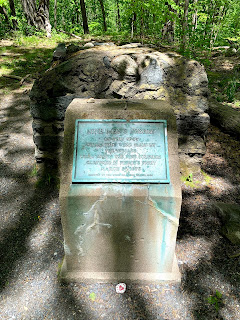 |
Nine Men's Misery Memorial
|
What is "
Nine Men's Misery"? you may well ask. This site dates back to 1679, when a large band of Narragansetts fought a pitched battle with soldiers from Plymouth Colony and their Wampanoag allies. The colonists were defeated, with nine survivors taken prisoner by the victors; according to period accounts they were tortured and killed. Their bodies, discovered by their fellow colonists, were buried on the site and a large memorial cairn erected. This edifice was disturbed on several occasions, such that in 1928 the Trappists, who saw themselves as custodians of the memorial, reinforced it, creating a concrete vault with a plaque that can be seen there to this day. As you walk the red trail, look for a short spur up a hill to your right; this leads directly to the monument. Returning to the red trail, continue until you come to an intersection with the yellow-blazed Cart Path Trail. The right hand fork returns to a parking lot on the road; take the left instead, and be on the lookout for a side-trail to the right blazed with white circles.
 |
The Monks' Quarry
|
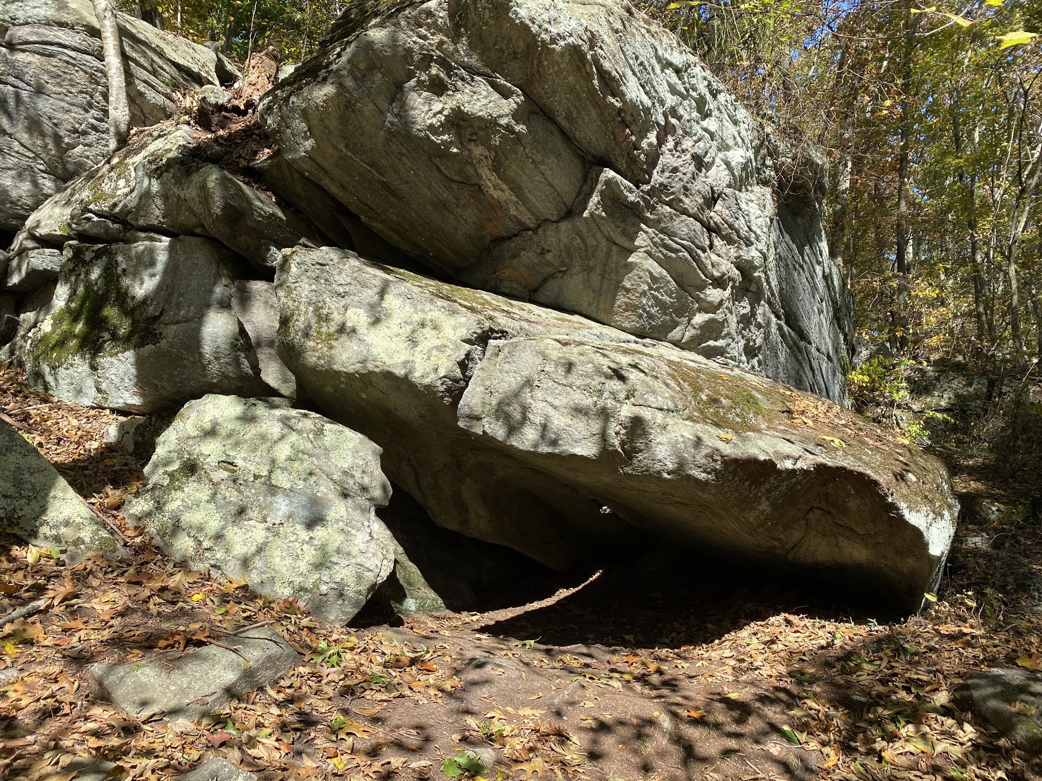
This is the Orchard Trail, which takes you to the crown of the hill, where the monks had an apple orchard. Little remans of it now, though the grape vines in the area suggest that perhaps the monks cultivated them as well. The trail doubles back briefly to yellow, then curves away to the right; a small spur will take you to an enormous modern water tank nearby. Continuing, you'll head back downhill and join the pink-blazed Homestead Trail. Take a right, and you'll merge with the green-blazed Monks' Quarry Trail; soon after you'll intersect the blue-blazed Whipple Trail where you'll take a second right. You'll follow the perimeter of the property (marked by a chain-link fence), after a leftward turn you'll skirt the edge of an enormous stone quarry. Climbing again, look for the green-blazed White Pine trail on your left, which which take you through a fragrant grove of these trees.
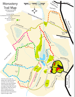
When you emerge back onto Whipple, take a left, and then return via the Monk's Quarry trail, this time keeping right so as not to repeat your earlier hike; you'll pass along the top of a stone dam and then come around the bend at the top of the Monks' Quarry. Here you'll see where the Trappists quarried their stone; a few half-finished pieces lie in a jumble, many of them heavily coated with moss -- it's a perfect place for a contemplative snack.
From there continue down until you intersect the yellow-blazed Old Road Trail; take a right (or, if you like, go out into the field an take the second right for a sunnier stroll). Either way, when you come to the main path, pass between the two lakes and you'll find yourself back where you started. If you fancy a further walk, keep to the right and stay on the broad gravel path; this is the Beauregard Loop, which circles the main buildings and eventually comes round once more to where you've parked. As a variation, on your next visit, park at the small lot at Lynch Park on Route 114. Here, you can take the yellow-blazed Cart Path from its beginning, passing under power lines and through broad fields; this connects with the Nine Men's Misery Trail and any of the above hikes. On your return, take the orange-blazed Lynch trail for a more wooded alternative route to your car.