It's one of the most beautiful hikes of any Land Trust properties in Rhode Island -- and also one of its best-kept secrets. Little would one suspect, driving through a neighborhood of upscale suburban homes on large lots, that just around the corner is the gateway to a wonderland? But there it is, accessed from a modest parking lot tucked between the houses. Connors Farm is one of those hybrid properties I've mentioned -- though the central area is managed by the Smithfield Conservation Commission, the further part of the property -- roughly where the yellow trail is located -- is managed by the Smithfield Land Trust.
 |
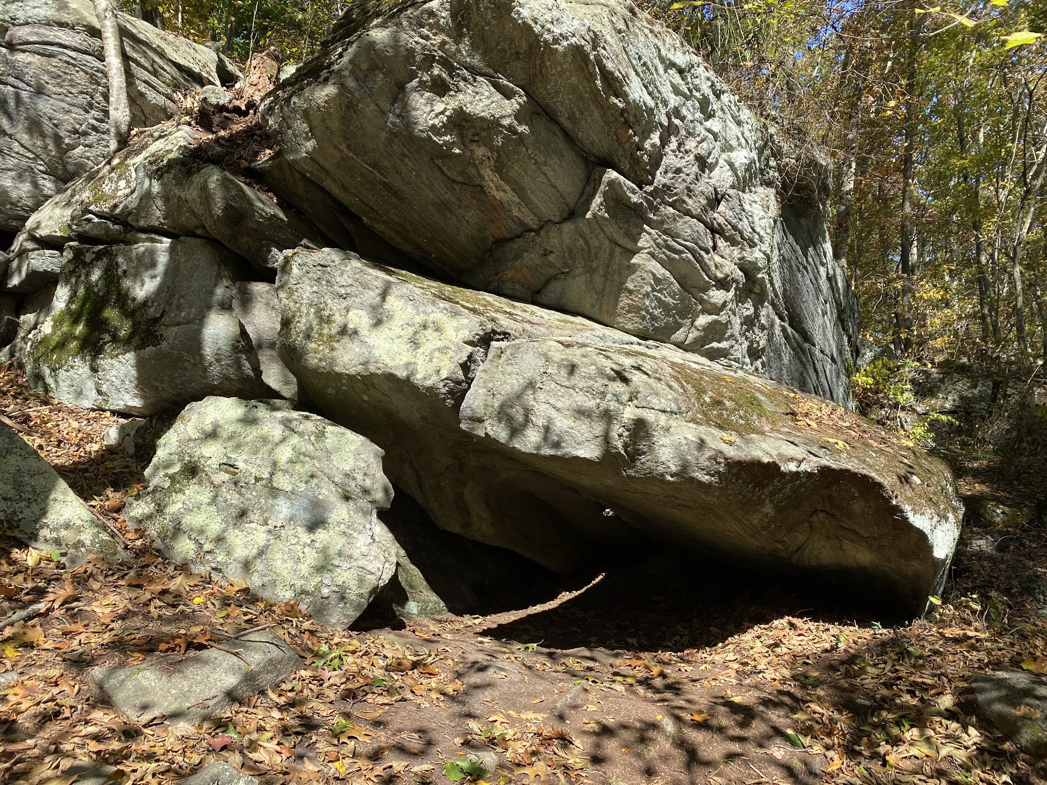
| The edge of the "biscuit" |
The first thing you'll see as you hike in from the parking lot is a dramatic heap of massive boulders. It's the leading edge of a glacial deposit that's commonly referred to as a "biscuit" in New England -- it resembles the side of an enormous crumbling cake of stone -- and the one here is the centerpiece of the trail system.
My preferred hike here begins by taking the red trail to the right. You'll cross a creek on a small quaint bridge, climb up and down a ridge, and pass along a low, marshy lake. Not long after this, you'll see the blue trail on your right -- take it -- and make a note when you come to a very sharp turn left. There is an unblazed trail that continues straight at this point -- you can take it if you like -- it crosses the creek on a very robust bridge and passes through the Caroline Judson Land Trust property. There's no outlet -- please be sure to observe private property markers -- but it's a pleasant there-and-back spur.
 |
| Cliffs off the blue trail |
Continuing on blue, you're in for a steep climb up the side of the "biscuit"; the trail briefly splits in two there. I recommend the right-hand branch, which passes along the cliff-side past several overhangs that might almost be called caves. Arriving at the top, you'll hit the yellow trail; take a right and continue along the top of things, dipping briefly for another stream crossing. Near here, you'll see an access path to the Burlingame Rd. entrance; continue on as you re-cross the creek on the route of an old carriage track. You'll soon come to another choice: a yellow-blazed connector to your right continues back to red, or you can finish the yellow loop and return by blue the way you came.
 |
A whimsical blaze
|
I prefer the former option; when you reach red again there's a picnic table with scenic views in non-leafy seasons. From there, continue right on red, descending from the biscuit steeply past some cliffs on your left that often attract rock climbers, You'll cross the creek one last time and then arrive back where you started.
For a variation -- one of my favorites -- you can park in the small lot off Mann School Rd,; the trail there will take you to red just at foot of the cliffs. From there, you can take red either way, and follow any of the above routes as you like.


No comments:
Post a Comment