Showing posts with label #nohorses. Show all posts

Friday, December 11, 2020

Trails of Blackall and Ballou

One of the lesser-known gems among Land Trust trails is the Blackall Family/Ballou Farm Preserve in Cumberland. It's also one of the newest; the trails have been maintained there by the Cumberland Land Trust just since 2016.

You'll find the trailhead parking in a gap in a stone wall at 8 Old West Wrentham Road. The entry trail, blazed white, will take you to the first of two extensive loop trails, blazed yellow. Take a right: you'll wander through stands of mature forest -- one of the largest I know that's nearly all hardwoods. Crossing a small stream, you'll pass by other stone walls, as well as a mysterious flight of steps that leads nowhere and a tree-platform or two. Take a right when you come to the red-blazed trail and descend along another stone wall before crossing past a small pond onto the other large loop, blazed blue. Here you'll pass by several 'sentinel' trees -- old oaks planted at or near stone walls, which date back to the time when this land was farmed.

Black mud, stones and roots, on creek bed
The farm here, operated by the Ballou family, can trace its origins back to Obadiah Ballou, one of three Ballou brothers who moved to the Cumberland area in the 1820's. In addition to them and the Blackall family, the area was also home to early settlers the Cook family, who arrived in 1632; several of their homes remain and can be seen on Old West Wrentham road (this is an older link from just before the current trail system and improvements were made -- you can get a sense of how much work it took to save and conserve this property).

About halfway along the blue trail, you'll come to a spur, also blazed white; it follows the path of a stream and eventually climbs up via a soldily-built staircase to the Cumberland Village shopping plaza. If you're considering taking larger groups on the trail, this could be an alternative starting spot, with plenty of parking.  Continuing along the blue loop, you'll return by the red trail once more; take a right at yellow and you'll finish the shorter part of that loop; return to you car via white. It's a good three miles to do both loops, and you won't find a more thoughtfully laid-out trail system anywhere in Rhode Island.


Wednesday, November 4, 2020

Connors Farm

It's one of the most beautiful hikes of any Land Trust properties in Rhode Island -- and also one of its best-kept secrets. Little would one suspect, driving through a neighborhood of upscale suburban homes on large lots, that just around the corner is the gateway to a wonderland? But there it is, accessed from a modest parking lot tucked between the houses. Connors Farm is one of those hybrid properties I've mentioned -- though the central area is managed by the Smithfield Conservation Commission, the further part of the property -- roughly where the yellow trail is located -- is managed by the Smithfield Land Trust.

The edge of the "biscuit"
The first thing you'll see as you hike in from the parking lot is a dramatic heap of massive boulders. It's the leading edge of a glacial deposit that's commonly referred to as a "biscuit" in New England -- it resembles the side of an enormous crumbling cake of stone -- and the one here is the centerpiece of the trail system.

My preferred hike here begins by taking the red trail to the right. You'll cross a creek on a small quaint bridge, climb up and down a ridge, and pass along a low, marshy lake. Not long after this, you'll see the blue trail on your right -- take it -- and make a note when you come to a very sharp turn left. There is an unblazed trail that continues straight at this point -- you can take it if you like -- it crosses the creek on a very robust bridge and passes through the Caroline Judson Land Trust property. There's no outlet -- please be sure to observe private property markers -- but it's a pleasant there-and-back spur.

Cliffs off the blue trail
Continuing on blue, you're in for a steep climb up the side of the "biscuit"; the trail briefly splits in two there. I recommend the right-hand branch, which passes along the cliff-side past several overhangs that might almost be called caves. Arriving at the top, you'll hit the yellow trail; take a right and continue along the top of things, dipping briefly for another stream crossing. Near here, you'll see an access path to the Burlingame Rd. entrance; continue on as you re-cross the creek on the route of an old carriage track. You'll soon come to another choice: a yellow-blazed connector to your right continues back to red, or you can finish the yellow loop and return by blue the way you came. 

A whimsical blaze
I prefer the former option; when you reach red again there's a picnic table with scenic views in non-leafy seasons. From there, continue right on red, descending from the biscuit steeply past some cliffs on your left that often attract rock climbers, You'll cross the creek one last time and then arrive back where you started.

For a variation -- one of my favorites -- you can park in the small lot off Mann School Rd,; the trail there will take you to red just at foot of the cliffs. From there, you can take red either way, and follow any of the above routes as you like.


Monday, October 5, 2020

Mercy Woods

A blaze along the Yellow Trail
I'm going to start with one of my favorite hikes in the state -- Mercy Woods -- which is administered by the Cumberland Land Trust. But first, a word about Land Trusts in Rhode Island generally -- each township has its own, though there is a shared goal of conservation of the land. The trusts have the ability to acquire land from private owners, as well as the responsibility to ensure that the land is preserved and conserved. You can learn more about how this works at the website for the Rhode Island Land Trust Council, which I'd recommend as the best place to learn about how this process works.

Mercy Woods takes its name from the Sisters of Mercy, a Catholic order devoted to caring for "people who are poor, sick, or undereducated." The Order's establishment in Cumberland, Rhode Island lay in the midst of more than 200 mostly wooded acres, including a high ridge overlooking the Diamond Hill Reservoir.  In 2018, in fulfillment of a longstanding wish of the community, 229 acres were transferred to the Cumberland Land Trust. At the same time, the town, with help from outside grants, was able to lay out a fine system of trails that circles and criss-crosses this newly-conserved land -- and it's one of the most beautiful trail systems in Rhode Island. The distinctive plastic blazes with their directional arrows are well-placed, making the trails easy to follow; as an additional bonus, part of the system intersects with the Warner Trail, a 30-mile trail that goes from the nearby Diamond Hill preserve all the way to Canton, Massachusetts.

So where to begin? The ideal starting point is a small parking lot on Sumner Brown Road just off Rhode Island Route 121. From there, you'll see a large grassy field; across the street is stone plaza which was originally a religious shrine. Start from the kiosk at the parking lot, where you'll be able to get a trail map, and head out on the Yellow Trail. The trail system is fairly straghtforward -- Yellow makes an unbroken inner loop around the property, while blue makes a larger arc around the eastern side. At variety of points, red-blazed trails, like spokes of a wheel, connect the inner yellow loop to blue. There is also a short purple trail -- white blaze markers with purple arrows -- known as the Grape Trail, which crosses over the hilltop and passes through grape arbors gone wild as well as open fields.

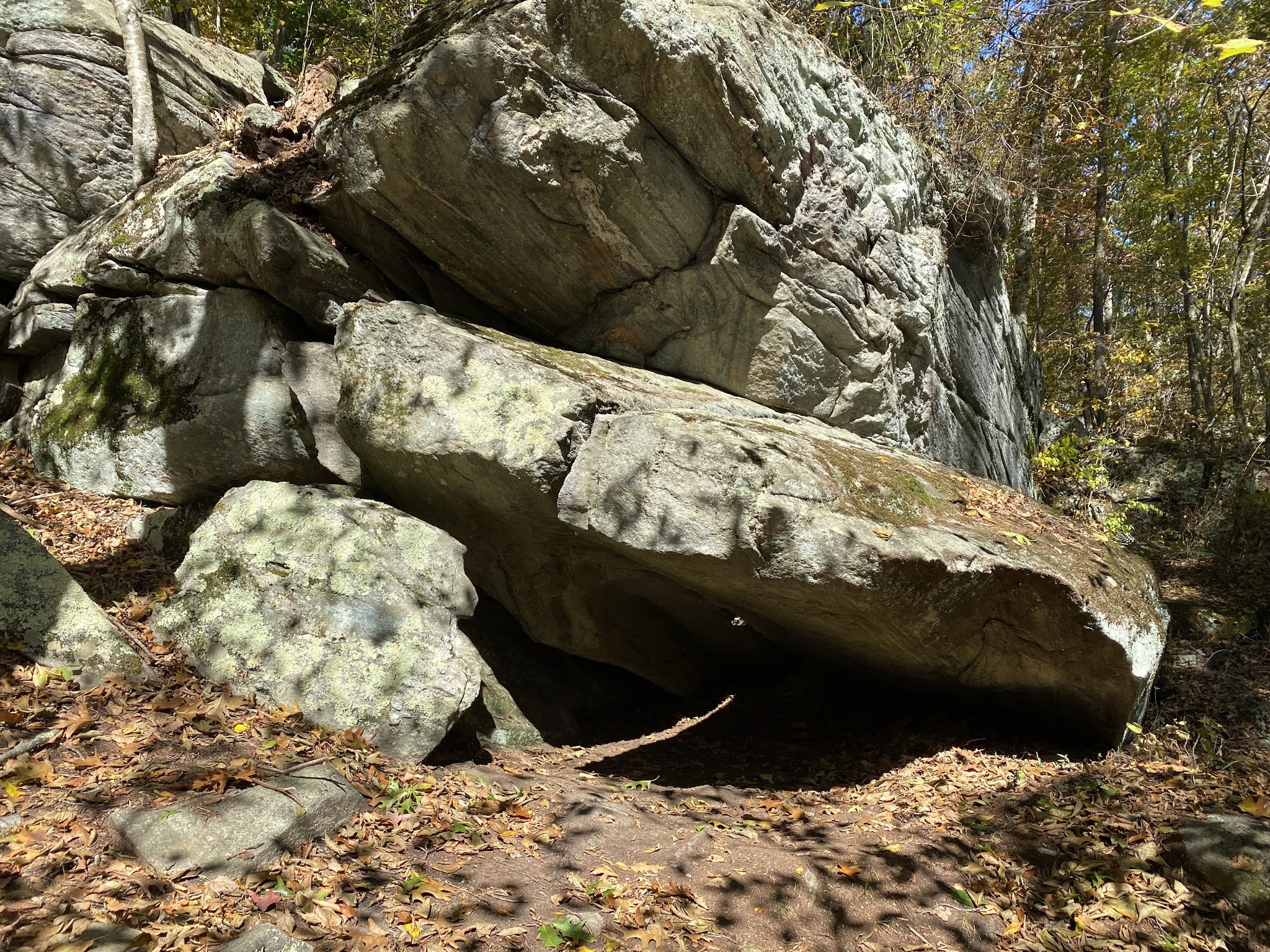
My recommended route continues along the Yellow trail, through forests of pine and oak, and crossing a small field near the hilltop. Shortly after this, take the Blue trail to the right; it follows stone walls and then ascends steeply to a ridge-top, from which in the leafless months there's a good view of the Diamond Hill Reservoir. As you descend the other side, you'll come to a cart-path where the blue blazes send you to the left; I prefer to go to the right where, after a gradual descent, you'll take the left-hand  fork in the road. 

The Warner Trail near Diamond Hill Reservoir
Look there for the small white discs that are the blazes of the Warner Trail -- these will guide you over a series of rocky ridges overlooking the reservoir, after which the trail winds around the hillside and re-joins the Blue trail. Continue on Blue, crossing Sumner Brown road, to where it rejoins the yellow trail near a large stone cairn; take yellow to the right and you'll soon find yourself back at the stone plaza across the street from the parking lot where you started. The great thing about this trail system is its variety -- you can take as much as you want of yellow or blue, and then cut over to the other loop via any of the red trails. The last of these red blazes (taking the recommended route) branches off from yellow through some lovely rocky forest to a small turnout off route 121; you can walk along this to return to the edge of the large field where you began.